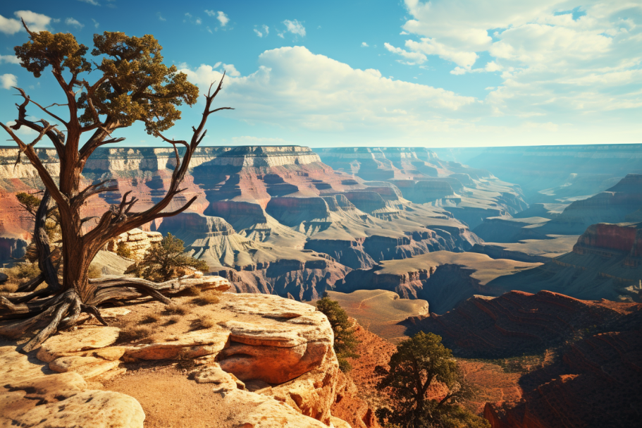
If you’re planning a trip to the Grand Canyon National Park, you’re in for a treat.
The Grand Canyon is a natural wonder of the world that must be experienced to be truly appreciated.
There are many ways to experience the canyon, but one of the most popular options is a day hike below the rim.
A day hike can be a life-changing experience, and it’s a great way to make the most of your visit to the park.
There are many different day hike options to choose from, ranging from one-hour hikes to full-day hikes.
In this article, we’ll share some of the best one-day Grand Canyon hikes to help you plan your trip.
Whether you’re a beginner or an expert hiker, there’s a hike for everyone in the Grand Canyon.
1. Hike South Kaibab Trail to Skeleton Point
If you only have a day to spend at the South Rim of Grand Canyon National Park, hiking the South Kaibab Trail to Skeleton Point is the perfect adventure for you.
This trail is considered a must-do and is known for its stunning views and steep switchbacks.
The South Kaibab Trail was built by the National Park Service in the 1920s and is an exposed ridge trail that offers breathtaking views.
The trail begins with steep switchbacks down a section called “The Chimney,” which is made up of the 250 million-year-old Kaibab limestone layer.
The descent can be treacherous in the winter, so it’s important to have trekking crampons.
After descending The Chimney, you’ll traverse through softer, sedimentary layers of sandstone and shale.
Look out for subtle, rippled designs in the sandstone, which tell the story of ancient, wind-blown dunes from 265 million years ago.
About 9/10 of a mile from the trailhead, you’ll reach Ooh Aah Point, a tight switchback with giant blocks resting above a dizzying drop-off.
This is a great spot to take a break, enjoy a snack, and take some breathtaking photos.
The trail continues to drop below Ooh Aah Point, with steep switchbacks at times and more gradual slopes at others.
At one point, the trail runs along the spine of a ridge with abrupt drop-offs on both sides, creating the illusion of a trail meandering to the end of the Earth.
Half a mile past Ooh Aah Point is Cedar Ridge, which is an excellent turnaround point for those not wanting to push themselves too far.
Cedar Ridge is a broad, open saddle with scraggly cedar trees, mule posts, and a bathroom.
The most dramatic scenery is behind you, and the way up is much more difficult than the way down.
If you choose to continue, you’ll pass through layers of red shale and mudstone, past saddles with jaw-dropping views into the Pipe Creek Drainage, eventually arriving at Skeleton Point.
This perfect turnaround point is almost exactly three miles from the trailhead and offers tremendous views of the surrounding cliffs, pinnacles, buttes, and side canyons.
It’s a fantastic place to enjoy a picnic lunch before turning around and ascending back up the South Kaibab Trail.
It’s important to note that this trail has no water and very little shade, so if you hike it in the summer, be sure to start early in the morning and bring plenty of water and food.
| Trail Information | |
|---|---|
| Trail Name | South Kaibab Trail |
| Trail Length | 6 miles round trip |
| Elevation Gain | 1,140 feet |
| Trailhead Elevation | 7,260 feet |
| Turnaround Point Elevation | 5,100 feet |
| Difficulty | Strenuous |
| Water Availability | None |
| Shade | Very little |
2. Grandview Trail to Horseshoe Mesa
The Grandview Trail is a historic trail that was built in the late 1800s by Pete Barry, a famous Grand Canyon miner, to access his copper mine at Horseshoe Mesa.
The trail is composed of hand-cobbled stones that Barry laboriously set one-by-one over 100 years ago.
The trail begins with steep switchbacks through the sheer Kaibab limestone layer.
This section of the trail can be intimidating for people with a fear of heights, as the trail is narrow, exposed and at one point it’s pinched off with a rock jutting out.
After the initial switchbacks, the Grandview Trail begins switchbacking steeply down the canyon walls to a pine-shaded saddle called Coconino Saddle.
The saddle provides an amazing view into the side canyon to the east of the trail, making it an excellent spot for a snack and relaxing break.
As you continue down the trail, the South Rim becomes farther and farther away up above.
The trail continues down through geologic layer after layer until eventually, after three miles, you reach Horseshoe Mesa.
The mesa is a huge, flat platform extending out into the space of the canyon.
On the south side of the mesa, you can still see the ruins of Pete Barry’s copper mine and rock cabin.
For ambitious hikers, heading out to the edge of the mesa to gaze down onto the Tonto Plateau is well worth it!
However, the hike out is back up the Grandview Trail, which is much more difficult than on the way down.
Be sure to save enough food, water, and energy to make it back to the South Rim.
In the summer, it is recommended to start this hike very early in the morning.
Below is a table summarizing the key features of the Grandview Trail to Horseshoe Mesa:
| Feature | Description |
|---|---|
| Trail Length | 6 miles round trip |
| Trail Difficulty | Strenuous |
| Trail Type | Out-and-back |
| Trailhead | Grandview Trailhead |
| Elevation Gain | 2,800 feet |
| Views | Coconino Saddle, Horseshoe Mesa, Pete Barry’s copper mine and rock cabin ruins |
| Tips | Bring plenty of water and snacks, start early in the morning in the summer |
Overall, the Grandview Trail to Horseshoe Mesa is a challenging but rewarding hike that offers stunning views of the Grand Canyon and its geological layers.
3. Bright Angel Trail to Plateau Point
The Bright Angel Trail is the most popular trail in the Grand Canyon, offering stunning views, shade, water, and bathroom facilities every 1.5 miles, making it an ideal choice for families and first-time hikers.
The trail is flexible, allowing hikers to turn around at any point, making it as easy or difficult as desired.
However, for those looking for a challenge, hiking to Plateau Point and back is a great option, covering 12 miles round trip with 3,000 feet of elevation gain and loss.
The trail starts with long, gradual switchbacks that pass through a narrow break in the 150-feet tall Coconino sandstone layer, followed by steeper switchbacks known as “The Elevator Shaft.”
The trail zig-zags back and forth, dropping quickly, and many hikers may think that hiking the Grand Canyon is not as hard as they thought.
However, the return journey is still ahead.
After hiking 1.5 miles down the Bright Angel Trail, hikers will reach 1.5 Mile Resthouse, which provides water, bathrooms, and shade (except in winter when the water may be disconnected).
After another 1.5 miles, hikers will reach 3 Mile Resthouse, which offers the same amenities.
The switchbacks level off and straighten out for half a mile below 3 Mile Resthouse, leading to Havasupai Gardens, a beautiful Cottonwood-shaded oasis fed by a gushing, clear spring.
Water, shade, and bathroom facilities are available here as well.
After resting and having something to eat at Havasupai Gardens, hikers will break off on the Plateau Point Trail to the west.
This trail rolls out over sagebrush-laden hills to the edge of the Tonto Plateau, providing one of the most dramatic viewpoints in the Grand Canyon National Park.
Plateau Point is 1,500 feet above the bottom of the canyon and almost directly over the blue-green (or brown, depending on the time of year) waters of the Colorado River.
The Inner Gorge, a chaotic, mashed up tangle of ancient rocks, contrasts dramatically with the neat, horizontal layers above it.
Visitors can see up and down the canyon and across into the Bright Angel drainage. Zoroaster Temple soars into the sky above, a beacon to all who know the Grand Canyon well.
The return journey is back up the Bright Angel Trail to the South Rim, where the hike started. However, hikers should be prepared for a long, arduous hike out.
It is not recommended to hike this trail in the heat of the summer as heat hazards can make it especially dangerous.
If you need a park map to get a sense of where everything is and to map out your hiking routes, you can purchase one of three Trails Illustrated maps covering different areas of the Grand Canyon National Park at REI.com.
